A 1900 Map of
Liverpool by Arthur Brown
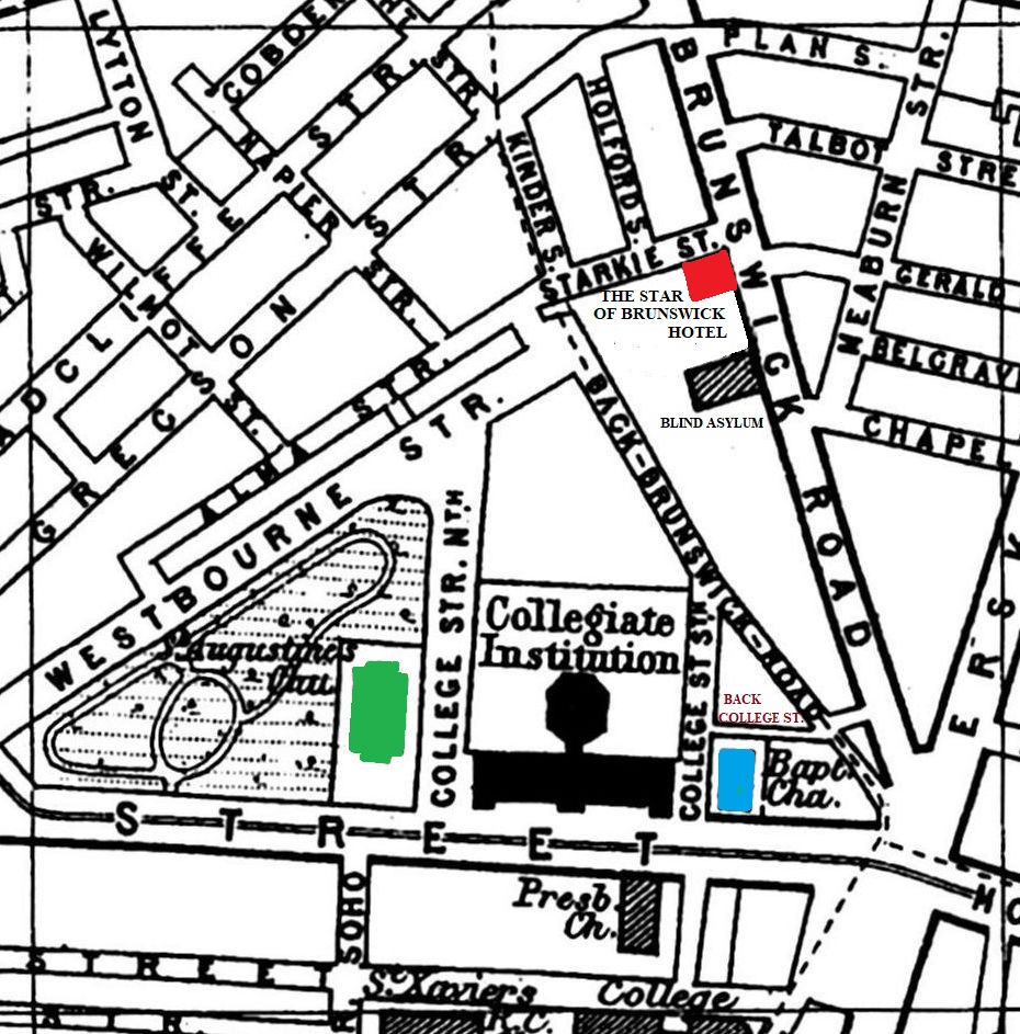
Use the Arrows to see other pages Schools & Places of Worship
This is Sheet # N7
| STREETS |
|
|
| Alma St
|
| Back Brunswick Rd
|
| Belgrave St
|
| Bright St
|
| Brunswick Rd
|
| Chapel Place
|
| Cobden St
|
| College St North
|
| College St South
|
| Devon St
|
| Epworth St
|
| Erskine St
|
| Gerald St
|
| Gregson St
|
| Guilford St
|
| Haigh St
|
| Holford St
|
| Kinder St
|
| Langsdale St
|
| Lytton St
|
| Meaburn St
|
| Moss St
|
| Napier St
|
| Plan St
|
| Radcliffe St
|
| Shaw St
|
| Starkie St
|
| Talbot St
|
| Westbourne St
|
| Wilmot St
|
Map Project © 2017 to 2022 by A. Brown art@justme.org.uk


