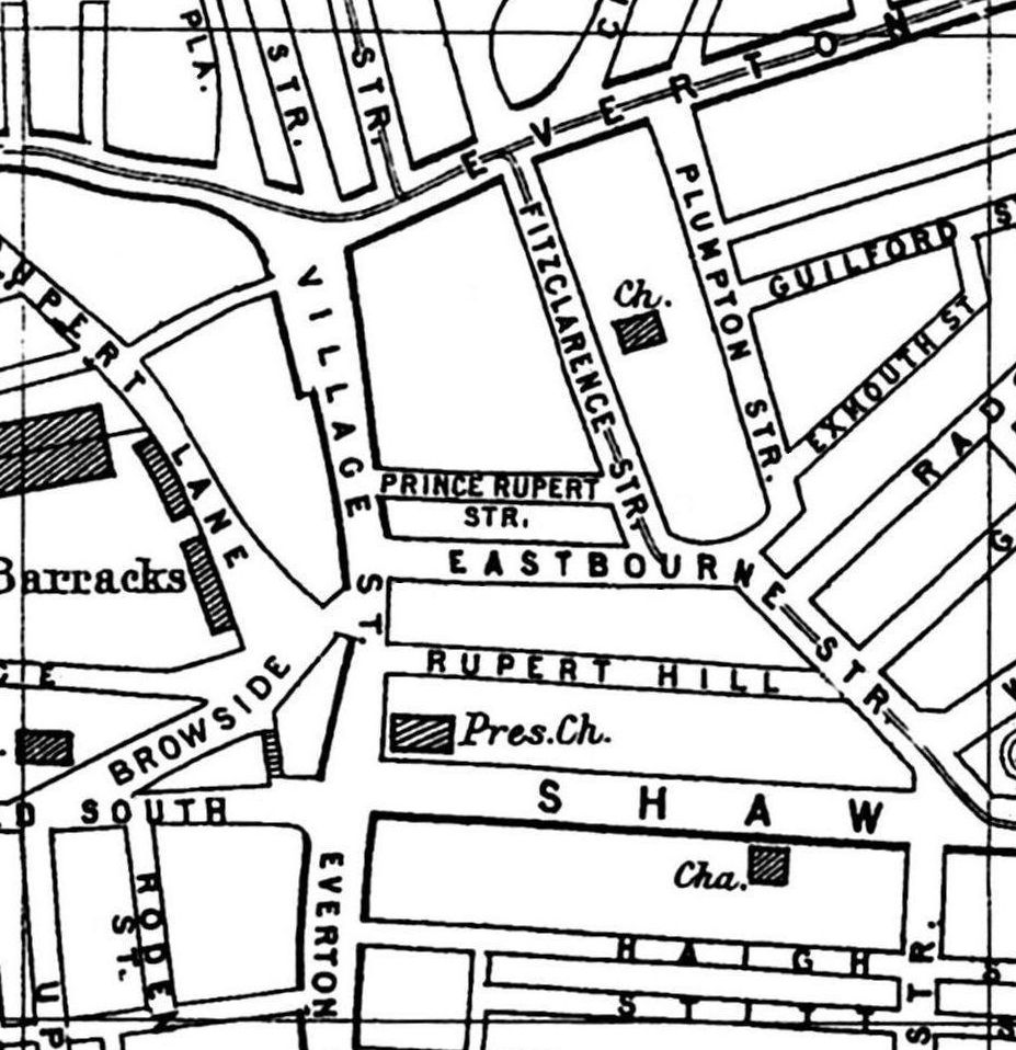
A 1900 Map of
Liverpool by Arthur Brown
Use the Arrows to see other pages Schools & Places of Worship
This is Sheet # M7
| STREETS |
|
|
| Aubery St
|
| Browside
|
| Creswell St
|
| Eastbourne St
|
| Everton Brow
|
| Everton Rd
|
| Everton Terrace
|
| Exmouth St
|
| Fitzclarence St
|
| Gregson St
|
| Guilford St
|
| Haigh St
|
| Heyworth St
|
| Hodson Place
|
| Lloyd St
|
| Mill Rd
|
| Netherfield Rd South
|
| Plumpton St
|
| Prince Rupert St
|
| Radcliffe St
|
| Roden St
|
| Rupert Hill
|
| Rupert Lane
|
| Shaw St
|
| Spencer St
|
| Stitt St
|
| Upper Beau St
|
| Village St
|
| Westbourne St
|
| William Henry St
|
Map Project © 2017 to 2022 by A. Brown art@justme.org.uk


