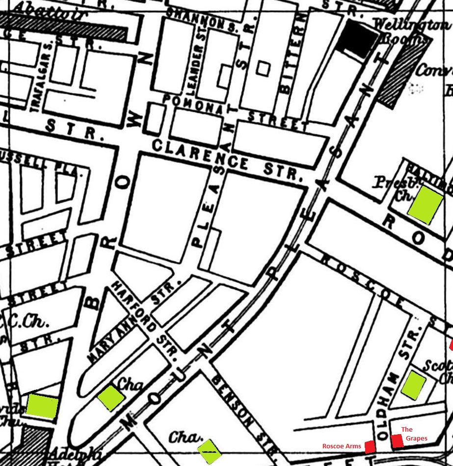
A 1900 Map of
Liverpool by Arthur Brown
Use the Arrows to see other pages Schools & Places of Worship
This is Sheet # P9
| STREETS |
|
|
| Ainsworth St
|
| Baltimore St
|
| Benson St
|
| Bittern St
|
| Blake St
|
| Brownlow Hill
|
| Clarence St
|
| Great Orford St
|
| Harford St
|
| Hawke St
|
| Jervis St
|
| Leander St
|
| Leece St
|
| Mary Ann St
|
| Mount Pleasant
|
| Oldham St
|
| Pleasant St
|
| Pomona St
|
| Renshaw St
|
| Rodney St
|
| Roscoe St
|
| Russell Place
|
| Russell St
|
| Shannon St
|
| St Andrew St
|
| Trafalgar St
|
| Trowbridge St
|
| Warren St
|
Map Project © 2017 to 2022 by A. Brown art@justme.org.uk


