A 1900 Map of
Liverpool by Arthur Brown
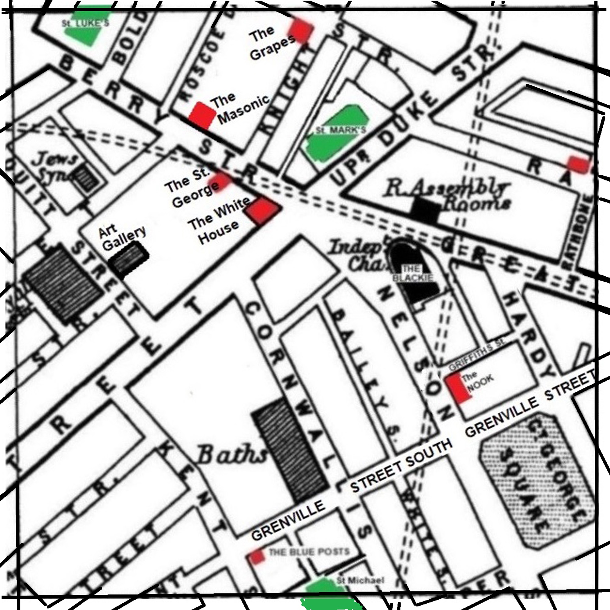
Use the Arrows to see other pages Schools & Places of Worship
This is Sheet # R10
| STREETS |
|
|
| Bailey St
|
| Berry St
|
| Bold Place
|
| Bold St
|
| Colquitt St
|
| Cornwallis St
|
| Duke St
|
| Great George Sq
|
| Great George St
|
| Grenville St
|
| Grenville St South
|
| Hardy St
|
| Henry St
|
| Kent Sq
|
| Kent St
|
| Knight St
|
| Lydia Ann St
|
| Nelson St
|
| Parr St
|
| Rathbone Place
|
| Rathbone St
|
| Rodney St
|
| Roscoe Lane
|
| Roscoe St
|
| Seel St
|
| St James Rd
|
| Suffolk St
|
| Upper Duke St
|
| Upper Pitt St
|
| White St
|
| Wood St
|
Map Project © 2017 to 2022 by A. Brown art@justme.org.uk


