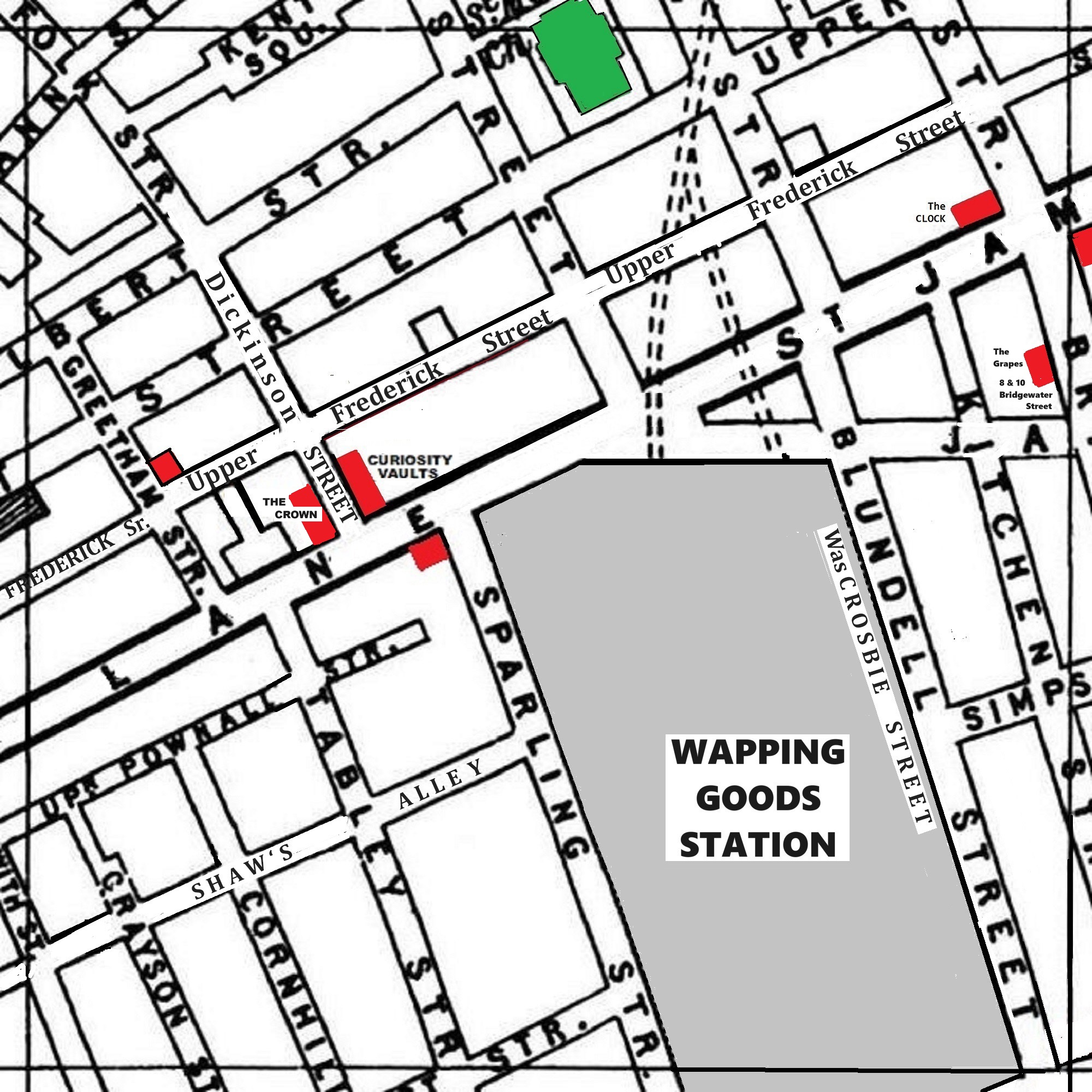
A 1900 Map of
Liverpool by Arthur Brown
Use the Arrows to see other pages Schools & Places of Worship
This is Sheet # R11
| STREETS |
|
|
| Beckwith St
|
| Blundell St [Crosbie St]
|
| Bridgewater St
|
| Cornhill
|
| Cornwallis St
|
| Crosbie St [old name]
|
| Dickinson St
|
| Gilbert St
|
| Grayson St
|
| Greetham St
|
| Hurst St
|
| Jamaica St
|
| Kent Sq
|
| Kent St
|
| Kitchen St
|
| Lydia Ann St
|
| Nelson St
|
| Park Lane
|
| Pitt St
|
| Shaws Alley
|
| Simpson St
|
| Sparling St
|
| St James St
|
| Suffolk St
|
| Tabley St
|
| Upper Frederick St
|
| Upper Pitt St
|
| Upper Pownall St
|
Map Project © 2017 to 2022 by A. Brown art@justme.org.uk


