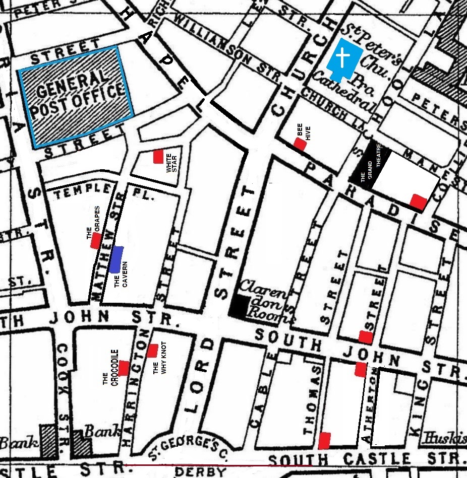
A 1900 Map of
Liverpool by Arthur Brown
Use the Arrows to see other pages Schools & Places of Worship
This is Sheet # O11
| STREETS |
|
|
| Atherton St
|
| Button St |
| Cable St
|
| Castle St
|
| Church Lane
|
| Church St
|
| Cook St
|
| Harrington St
|
| King St
|
| Leigh St
|
| Lord St
|
| Manesty Lane
|
| Matthew St
|
| North John St
|
| Paradise St
|
| Peter St
|
| Peters Lane
|
| Princes St
|
| Richmond St
|
| School Lane
|
| Sir Thomas St
|
| South Castle St
|
| South John St
|
| St Georges Crescent
|
| Stanley St
|
| Tarlton St
|
| Temple Place
|
| Temple St
|
| Thomas St
|
| Victoria St
|
| Whitechapel
|
| Williamson St
|
Map Project © 2017 to 2022 by A. Brown art@justme.org.uk


