A 1900 Map of
Liverpool by Arthur Brown
Use the Arrows to see other pages Schools & Places of Worship
This is Sheet # W9
| STREETS |
|
|
| Aberdeen St
|
| Barter St
|
| Beresford Rd
|
| Bowring St
|
| Brenton St
|
| Byles St
|
| Clevedon St
|
| Collins St
|
| Creta St
|
| David St
|
| Digby St
|
| Drysdale St
|
| Erith St
|
| Ernest St
|
| Fairview Place
|
| Haliburton St
|
| Hawkstone St
|
| Isaac St
|
| Jacob St
|
| Leonora St
|
| Mather St
|
| Melville St
|
| Miles St
|
| Miller St
|
| Moses St
|
| Moville St
|
| Ouse St
|
| Park Hill Rd
|
| Park Rd
|
| Peel St
|
| South St
|
| Tavistock St
|
| The Elms
|
| Threlfall St
|
| Welfield Place
|
| Wilson St
|
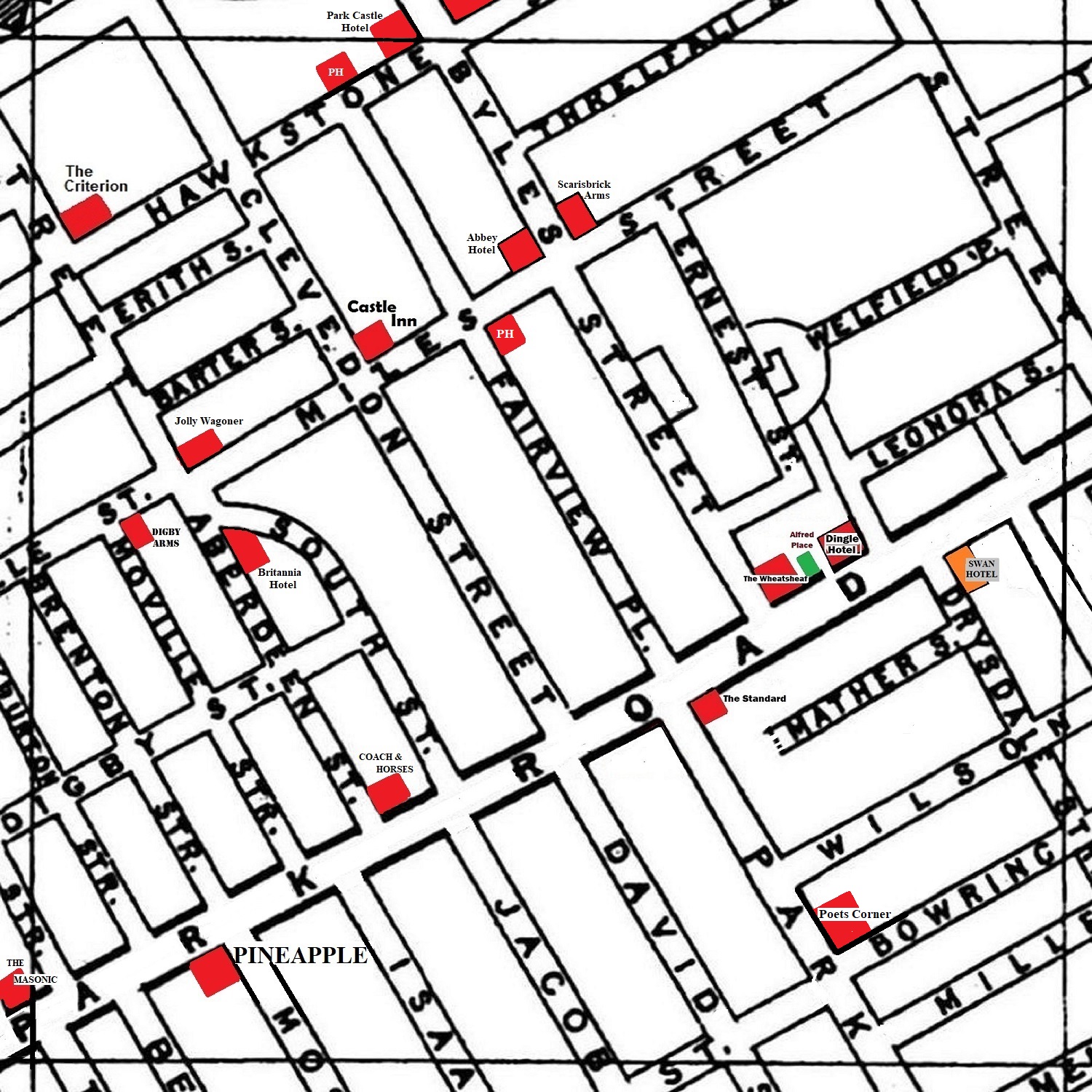
Map Project 2017 to 2022 by A. Brown art@justme.org.uk


