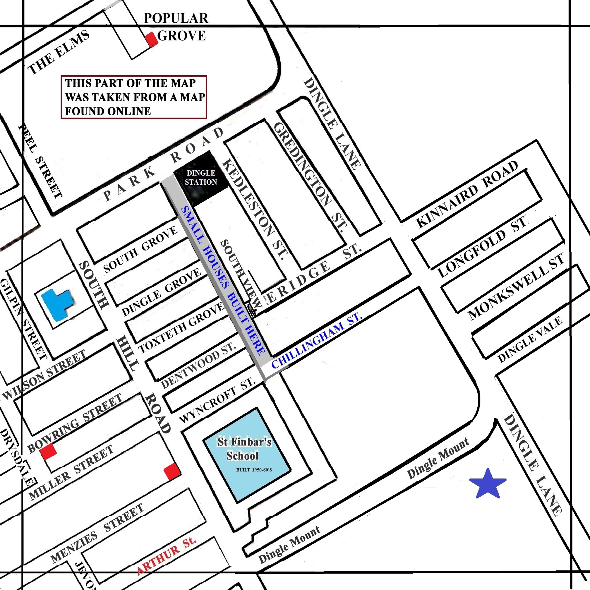
1900 Map of
Liverpool by Arthur Brown
Use the Arrows to see other pages Schools & Places of Worship
This is Sheet # X9
| STREETS |
|
|
| Arthur St
|
| Bowring St
|
| Chillingham St
|
| Credington St
|
| Dentwood St
|
| Dingle Grove
|
| Dingle Lane
|
| Dingle Mount
|
| Dingle Vale
|
| Drysdale St
|
| Eridge St
|
| Gilpin St
|
| Kedleston St
|
| Kinnaird Road
|
| Longfold St
|
| Menzie St
|
| Miller St
|
| Monkswell St
|
| Park Rd
|
| Peel St
|
| Popular Grove
|
| South Grove
|
| South Hill Rd
|
| South View
|
| The Elms
|
| Toxteth Grove
|
| Wilson St
|
| Wyncroft St
|
Map Project 2017 to 2023 by A. Brown art@justme.org.uk


